Tuesday, December 7, 2010

04 Dec 2010 - Seamounts and Salps


It was around 5 in the morning. Katie and I were performing titrations with sea water of different salinities in order to find the densities of individual salps, and I happened to look outside. It was the first crystal clear sunny day in a while and there were hundreds of birds swooping down to the water. A dozen or so penguins broke the surface of the water, porpoising. Porpoising is when penguins leap out of the water while swimming, making them look like they’re pretending to be porpoises. Katie and I ran up to the 01 deck (above the main deck where we work) to see the feeding frenzy. A couple of whales spouted. The boat steamed steadily along, and we realized that we and the people on the bridge (where you steer the boat) were probably the only ones who had seen this. The pictures I took did not adequately represent the explosion of life that we witnessed on that cold crisp sunny morning.

When we returned to the lab, the ADCP (Acoustic Doppler Current Profiler; also shows bottom contour) showed that we had just passed over a sea mount. 

A seamount as seen on the ADCP computer. 

Sea mounts are underwater features that are typically associated with high levels of biological productivity. This is often due to the upwelling of nutrient-rich deep waters that they cause.

- Karen

Saturday, December 4, 2010

November 30th: Science!

We left Palmer Station around noon today, heading for our first sampling station, but because of an apparently massive low pressure system sitting over the Drake, we had to veer a bit off course to a more sheltered area where we wouldn’t be beaten to a pulp. We rerouted to a different station to work out the kinks in our sampling methods. The work started almost immediately that afternoon with the first of many CTD’s and net tows to come. Katie and I were on shift and were a little bit frazzled once we realized that we didn’t really have much of any idea of what we were doing! We didn’t catch too much in the net, but if you ask me, it was a decent first catch – small enough that our heads didn’t explode at the thought of sorting, identifying, and counting them all, but comprised of most of the common species that we will be seeing in the majority of our tows.


We’re working ~12 hour shifts, which means (at least for Karen and I who work the night shift) that we get to watch the sun set and then rise again a few hours later! The first day of science had an especially pretty sunset and the sunrise was just as good with ice in the background being illuminated by the sun. 

The field team on the backdeck of LM Gould looking extremely serious for some reason (from left to right: Katie, Karen, and Melissa).
Getting ready to dissect Wolfie (the Stony Brook University mascot) in the wet lab.


- Melissa

03 Dec – One week down...


We left Punta Arenas on Thanksgiving Day, but have only been doing our science stations for the past 3 days. Things are going fairly well so far; we're catching zooplankton (salps and krill primarily) in our net tows which is great as we've got animals to do our experiments onboard the ship. However, we have had to skip (or move the location) a few of our planned stations. As we headed towards one station last night, the Captain came down and suggested that I may want to consider moving our station location a bit south (towards the north side of King George Island) as he was starting to see swells that were ~ 28 ft high. So we did that and it's worked out pretty well.

Alarm --- fire drill time!

OK, back from the fire drill. Roughly once a week, the ship will ring the alarm bells unannounced and while the crew goes to their prepared stations and duties (depending on which alarm bell signal was heard), the scientists all muster in the lounge. You have to bring your life jacket and survival suit (and it's a good idea to bring a jacket and hat as well) and we take attendance and make sure the science party is accounted for. Sometimes, if there is a super-great chief scientist onboard, he'll even bring a chocolate bar that gets passed around!

Now that the drill is over, it's back to the science. We haven't really talked about what we're doing on this trip so I'll try to explain that now. In the Antarctic ecosystem, krill are the primary food source for all of the larger animals that exist down here (like whales, seals, penguins, and other sea birds). Unlike other oceanic ecosystems which have many different types of animals, almost all the energy in the Antarctic food web passes through krill at some point.

Antarctic krill, Euphausia superba, are crustaceans that can live up to 7 years and as adults are around 5 cm (2 inches) in length.

In some places or times in Antarctica, you can find very high abundances of another zooplankton, namely the salp (Salpa thompsonii). These animals are gelatinouus (sort of like jellyfish) and are mostly transparent in the water except for their gut which is usually a dark red or brown color. Salps often occur in long chains of animals all connected to each other, or sometimes you'll find solitary (and larger) salps as well. Salps and krill are believed to be in competition for phytoplankton resources (i.e. they compete for the same food) and in some years you find lots of krill and in other years you find lots of salps. The salps are less nutritionally valuable to predators so if you have lots of salps and less krill, that may have a negative impact on the birds and mammals that feed on krill. One hypothesis is that as the climate changes (and the Antarctic peninsula is warming at a much more rapid rate than the earth as a whole), we may see decreases in how much sea ice forms each winter which is believed to be a better environment or conditions for salps than for krill. So some people think we may be seeing a shift in the abundance of salps down here.

Salps are kept in a cold room in aerated aquaria. In this tow, we caught lots of small (1 cm length) salps but also a couple of very large salps (~ 10 cm in length). Amazingly some of the salps were still in their chain form despite being brought up in the IKMT net!

In order to measure how many salps or krill there are in any area, you have to count the animals in the ocean. If you use a net to capture these animals, it can be difficult to count how many salps there were as they are very fragile and can get destroyed by the net tow collection process. We're doing fairly shallow and short net tows so the animals that we bring up are in good shape for our experiments.

One of our goals on this trip is to assess the utility of using acoustic echosounders (which are scientific instruments similar to fish finders you see on most boats) to measure the presence or abundance of salps. Since we're sending out acoustic waves, we don't damage the animals in the process and we can cover a lot more area using a boat with an echosounder than if we are only using net tows. We can use acoustics to survey krill fairly well in this environment, but we'd like to be able to do the same thing for salps. In addition to collecting acoustic data during our survey, we're measuring various properties (size, shape, animal body properties) of the salps we catch to see if we can use that information to better interpret our acoustic survey data. It's a pretty complicated process, but the overall goal of our project is to improve our ability to remotely measure the abundance of salps in this region and then to see if there are changes in salp abundance either spatially, over time, or correlated with other environmental parameters. And if we can measure how many salps there are and if that's changing in space or time, then that can give us insight into how the presence of salps might affect the Antarctic ecosystem and the larger animals that live in these waters.

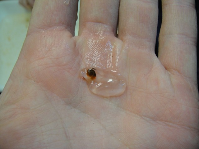
This is not one of the normal krill predators you would find in Antarctica. For the record, krill don't really taste like anything, mostly salt-water. They are full of omega-3 compounds so you can find Krill Oil dietary supplements in many health food stores next to the fish oil section.

We'll try to provide some more pictures of the actual experiments in the next couple of days. We're just excited to have lots of animals onboard the boat so we can do our projects.

-Joe

29 Nov - From the Drake to Palmer Station and More

[Editor's note: The first leg of our sampling has stations every 3 to 4 hours which means there's little downtime for the field team so the Chief Scientist is the reason for this post showing up a few days late.]


On November 29th, the LMG Gould passed from the Drake Passage and into the straits leading to Anvers Island and Palmer Station, one of three major United States research stations on the Antarctic continent. Stepping out onto the deck, I was taken with the scenery, and I mean mouth-open eyes-wide, taken! The land surrounding the narrow strip of water on which we traveled was sincerely different from anything I had ever seen before. Rock, ice and snow dominated the landscape. Darkened by deep grey skies, parts of the landscape were highlighted by bold dashes of sunlight breaking through the clouds.

The landscape on our way through the Gerlache Strait.

Not only were we greeted with a new landscape, accompanying fauna including penguins and whales, but also by sea ice! There are many classifications of sea ice including pancake ice, bergie bits, growlers, ice bergs, and many more.

A flow chart of the different types of ice.

These floating pieces of ice are considered growlers!

Docking the LMG at Palmer station is like parking a whale; it is a feat of precision. We met the Palmer folks with some friendly snowball fire. 

Ammunition awaits.
Palmer Station, Anvers Island. 

We had a great time at Palmer, and enjoyed their hospitality immensely.

-Karen

Thursday, December 2, 2010

2 December 2010 – Salps !


We began our research sampling yesterday after a bit of delay due to that large low pressure system that was passing by. Luckily, the center of it slid a bit north which meant the winds (and waves) on the southern side (where we were) weren't too bad.

We've completed two stations so far. At each station we lower an instrument called a CTD which measures the physical properties of water and how they vary with depth. Various parameters like salinity, temperature, density, dissolved oxygen, and fluorescence can give us an idea of how physically mixed-up parts of the water column are and whether there is a lot of primary productivity occurring (i.e. plants growing). The CTD also has a rosette of Niskin bottles along the outside which we use to collect water samples from various depths. These samples are processed to see what types of phytoplankton (ocean plants) are present.

The CTD rosette is lowered out of a door on the side of the ship with Marine Tech Chance Miller guiding it on its way.
After the CTD, we deploy a net to collect animals from the ocean. We have two types of nets on this cruise which work roughly the same way. We lower them into the water and let out wire. The nets fly downward in the water column and collect any animal that is big enough to be caught by the mesh and small enough not to be able to swim away from the net. When the nets reach the deepest point of their path, we start hauling back in on the wire and bring them back to the surface. Nets are an essential part of oceanography as they provide you with organisms that were in the water where the net flew. However some animals can be damaged by the net collection process so oftentimes we are doing short tows to try and bring the animals up on deck in good shape.

The IKMT (Isaacs-Kidd Midwater Trawl) net is deployed off the stern of the ship.
We end up filtering several hundred (or even a thousand) cubic meters of water with each tow. But because the zooplankton (the name for small animals in the ocean that generally move with the water) occur in patches or aggregations in the ocean, sometimes the net comes up empty and sometimes it comes up full. Our first net had a single adult Antarctic krill (Euphausia superba) but a hundred or so pteropods (pelagic snails) and chaetognaths (transparent arrow worms). Our second net had a lot of algae, more pteropods, and salps which is good as one of our primary research goals is to collect salps for ship-board experiments.

Our very first salp caught on the trip. Hopefully we'll catch a lot more!
But working on the ocean doesn't always go smoothly. We just had to cancel our CTD and net deployments at Station #3 due to the sea state being too large to deploy our gear safely. The safety of the deck crew and the equipment onboard is very important so we tend to err on the side of caution. We definitely can't replace most of the equipment on board if we were to lose it, and the people are even more valuable. Sometimes you just can't sample, so we're steaming towards our next station and hoping the conditions improve.

Working here in the late spring/early summer (the seasons are opposite of what's going on in the Northern Hemisphere) offers some neat experiences. We have a only a few hours of night and it never seems completely dark (more twilightish), but that means you sometimes have a sunset or sunrise where there's just a beautiful orange glow on the horizon for a few hours.

Last night we had a very nice sunset.
-Joe

Wednesday, December 1, 2010

Weather or not...

One of the features of working on a ship is that the weather (and sea) conditions play an important role in determining what you can and can't do (research-wise) from the boat.  In order to safely deploy and
retrieve equipment, the ship and deck crew are often at the mercy of the sea.  As we sailed away from Palmer Station this morning (we're a few blog posts behind right now but they should show up soon), I met with the ship's Captain (or Master) Sebastian who showed me this weather map:

There's a large low pressure
system stretching from continent to continent which means we may be
getting some rough weather as we attempt to begin our survey.


The map shows a large low pressure system that covers almost all the area between the Antarctic peninsula and the southern tip of South America. Where you have large pressure gradients, you get strong winds. Where you have strong winds (and lots of fetch or area for that wind to blow over), you get large waves.  We're headed toward our first station, but it's not clear if we'll be able to get there tonight. Or if we do get there, whether or not we'll be able to safely deploy the CTD, net, or acoustic systems on the ship. I'm going to go catch a couple of hours of sleep and see how things look when I get up (or somebody wakes me up). One of the benefits (features?) of being Chief Scientist on the cruise is that I'm never really off the clock, so I can expect to be woken up if there are any issues that might arise while I'm asleep.  So I generally try to catch some shut-eye whenever I know there'll be a couple of hours of transiting ahead of us.

Last night after we were done off/on-loading cargo and then continuing this morning before we left the dock, we started to test out the equipment that we'll be using on the cruise.  The blue thing hanging off the stern of the Gould is our acoustic towfish which contains a two-frequency echosounder that we will use to assess what types of small animals are in the ocean. We tow it from the ship while we transit between stations, but in order to get useful information from the instrument we have to calibrate it. In this case, that means hanging some metal spheres underneath it, lowering the whole thing in the water and measuring the echoes (from sound we transmit) that reflect off the spheres.  We had a couple of hiccups with the data recording end of things but thanks to our two ETs (Mike and Tony) we got those straightened out this morning and that piece of equipment is ready to go.  We also tested our small-boat mounted echosounder which also was working well.

Our acoustic towfish being lowered into
the water at the pier at Palmer Station (various buildings are in the
background). This instrument is like the fish-finder on a boat (except a
lot more complicated) and we'll use it to detect small animals in the
ocean as we do our survey).


Caption: ETs (Electrical Techs, not
extra-terrestials) Tony (left) and Mike (right) pose for a picture with
our towfish before craning it over the side of the ship.


- Joe

29 Nov 2010 - Land Ho!

Yesterday everyone onboard was abuzz with the promise that we'd spot land on the horizon around 1600.   The first land we set eyes on after 4 rocky days was Smith Island.  It looked like a big iceberg! I went up to the bridge to check it out and take some photographs.  As we got closer to the peninsula, it was not uncommon to see penguins swimming.  They travel by "porpoising"; they burst out of the water every few seconds as they swim, similar to porpoises.  One of our on-board ornithologists, Steve, told me its more energy efficient than staying underwater.  Cool!

Smith Island.  It blends right in with the gray sea and sky.

We also broke out the board game Settlers of Catan, which is one of my favorites.  It was a pretty close game, but in the end Karen was victorious.  When the seas are rough, it is not easy to forget you are on a ship; it was necessary to tape down the game pieces to keep them from sliding away!


Pintado Petrel, Daption capense, commonly seen flying around the ship.  Its easy to see how they got their name!


 -Katie